Close Menu
    Facebook X (Twitter) Instagram
    FirstWorksheets
    Pinterest
    • Home
    • Math
      • Multiplication Tables
      • Crack The Code
    • Skills
      • Conflict Resolution
      • Communication Skills
      • Gratitude
      • Kitchen Safety
      • Life Skills
      • Needs and Wants
      • Self Esteem
      • Social Skill
    • Personal Development
      • Emotion Worksheets
      • Growth Mindset
    • Spot The Difference
    • All About Me
    FirstWorksheets
    Home»4th Grade»Map Skills»Latitude & Longitude»Latitude & Longitude Based on Label Image Worksheets
    Latitude & Longitude

    Latitude & Longitude Based on Label Image Worksheets


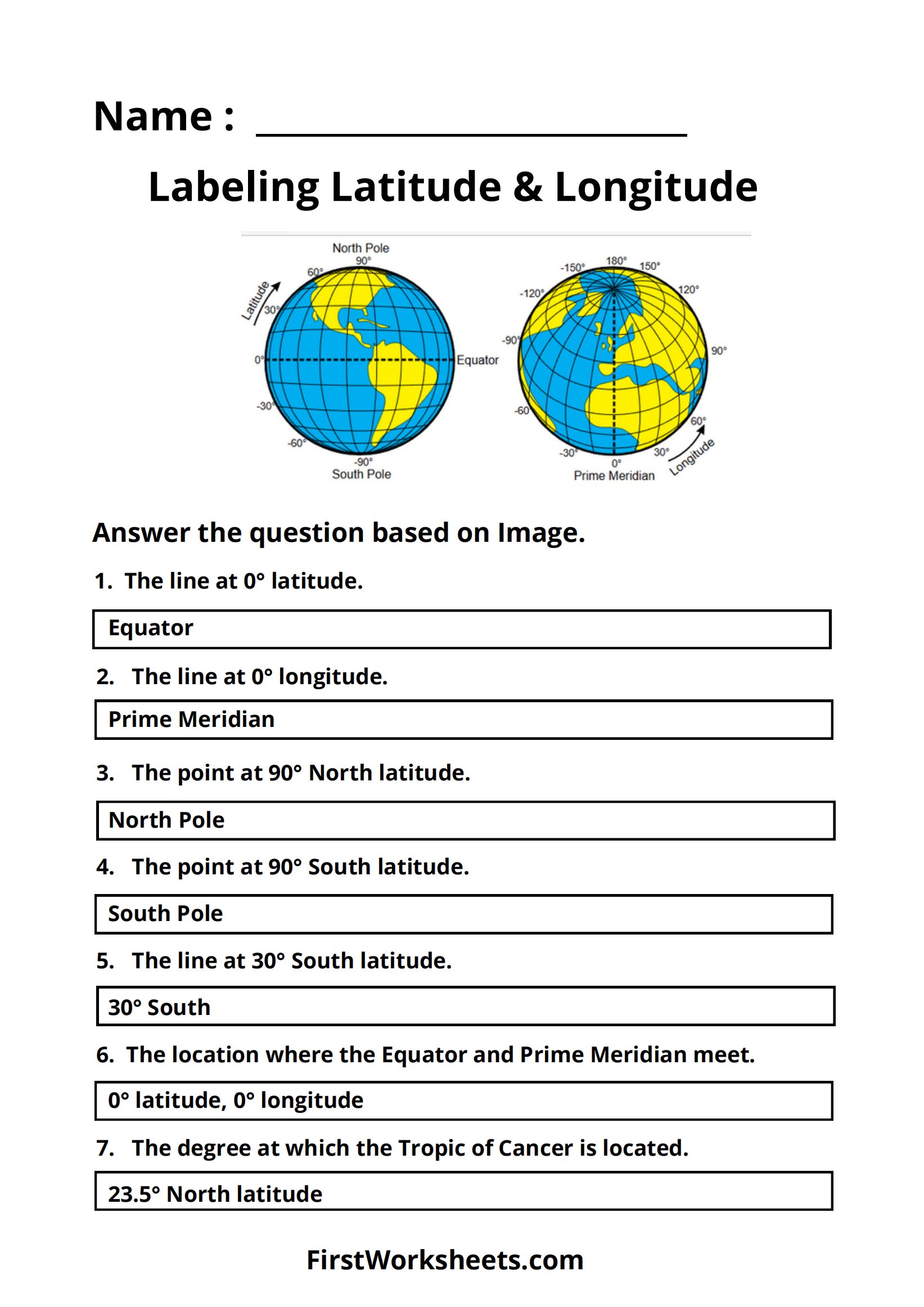
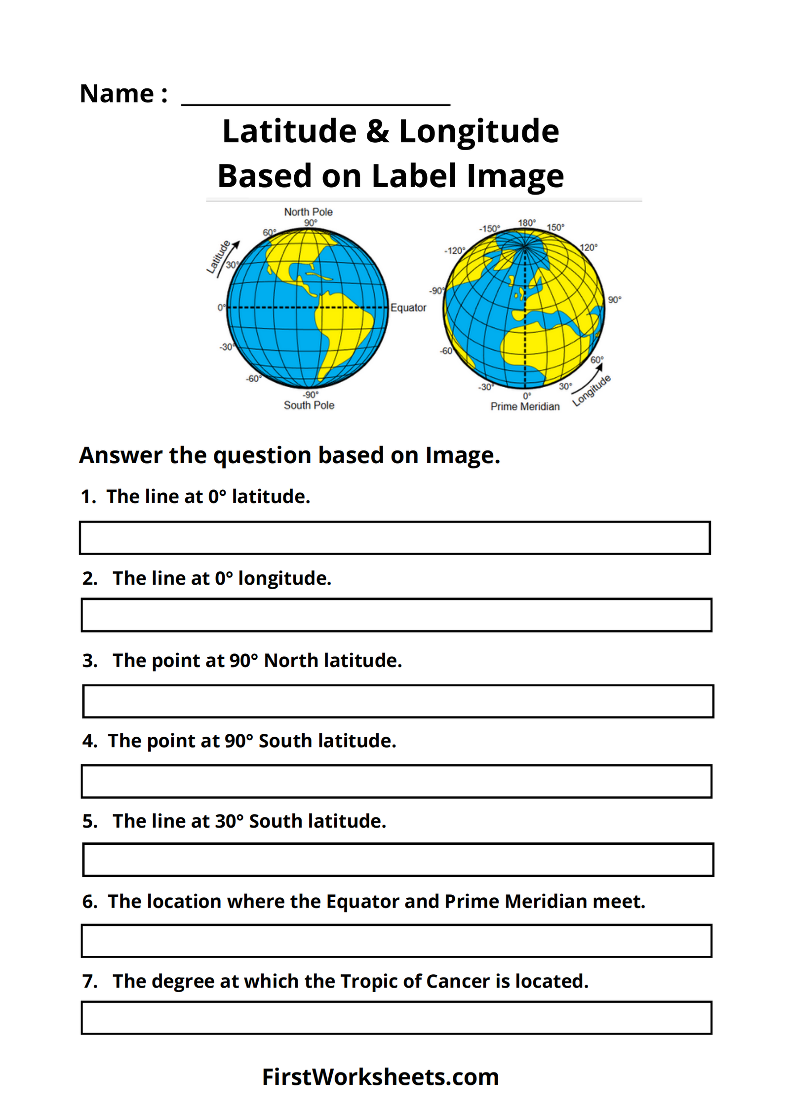
    This worksheet focuses on understanding latitude and longitude, which are the coordinates used to locate places on Earth. The worksheet includes an image of a globe with latitude and longitude lines, and questions that ask students to identify specific lines, points, and intersections.

    • Purpose: The main purpose of this worksheet is to help students learn about the geographic coordinate system and how to read latitude and longitude.
    • Key Concepts:
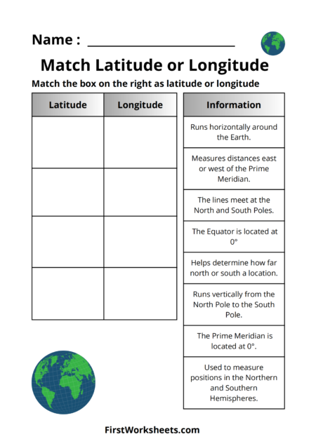
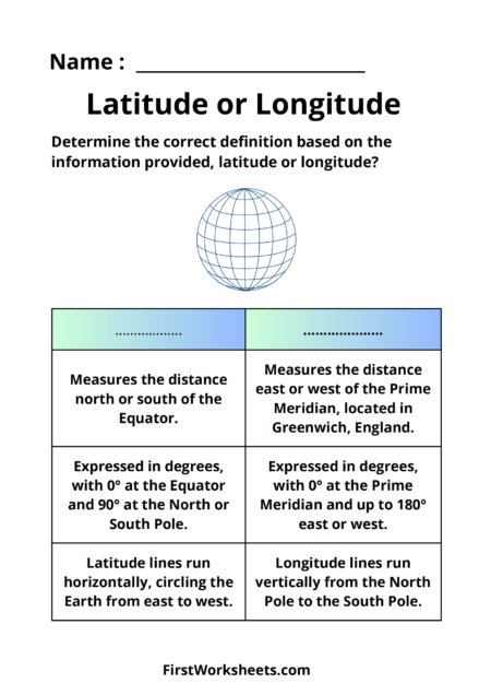
      • Latitude: The horizontal lines running east-west, measuring distance north or south of the Equator (0 degrees latitude).
      • Longitude: The vertical lines running north-south, measuring distance east or west of the Prime Meridian (0 degrees longitude).
      • North Pole and South Pole: The points located at 90 degrees North and 90 degrees South latitude, respectively.
      • Equator: The line at 0 degrees latitude, dividing the Earth into Northern and Southern Hemispheres.
      • Prime Meridian: The line at 0 degrees longitude, passing through Greenwich, England, and dividing the Earth into Eastern and Western Hemispheres.

    By completing this worksheet, students will:

    • Learn to identify key lines of latitude and longitude.
    • Understand the significance of the Equator, Prime Meridian, North Pole, and South Pole.
    • Practice reading coordinates and locating points on a map or globe.
    • Gain a foundational understanding of the global coordinate system, which is essential for geography and navigation.
    Latitude & Longitude Based On Label Image Worksheet

    Answer Key

    Latitude & Longitude Based On Label Image Worksheet Answer Key
    Download PDF

    Share. Facebook Twitter Pinterest LinkedIn Tumblr Email

    Related Posts

    Match Latitude or Longitude Worksheets

    Match Latitude or Longitude Worksheets

    Latitude or Longitude Worksheets

    Latitude or Longitude Worksheets

    Latitude or Longitude Test Worksheets

    Latitude or Longitude Test Worksheets

    Latitude or Longitude Exercise Worksheets

    Latitude or Longitude Exercise Worksheets

    Latitude or Longitude Based Image Worksheets

    Latitude or Longitude Based Image Worksheets

    Leave A Reply Cancel Reply

    © 2025 FirstWorksheets.com
    • About Us

    Type above and press Enter to search. Press Esc to cancel.